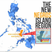
ABOUT NEGROS ORIENTAL Negros Oriental (Cebuano: Sidlakang Negros), also called Oriental Negros or "Eastern Negros", is a province of the Philippines located in the Central Visayas region. It occupies the southeastern half of the island of Negros, with Negros Occidental comprising the north-western half. It also includes Apo Island — a popular dive site for both local and foreign tourists. Negros Oriental faces Cebu to the east across the Tañon Strait and Siquijor to the south east. The primary spoken language is Cebuano, and the predominant religious denomination is Roman Catholicism. Dumaguete is the capital, seat of government, and most populous city of the province.
Origin of Negros Oriental
Negros Island, the third largest island in the Philippines, is believed to have once been part of the island of Mindanao, but was cut off by rising waters at the end of the last ice age.
Among the early inhabitants of the island were Negritos, as well as Han Chinese and Malays. They called the island "Buglas", a native word which is believed to mean "cut off".
Spanish explorers on the expedition of Miguel Lopez de Legazpi first came to the island in April 1565. Legazpi dropped anchor in Bohol and sent his men to scout the island.[5] Because of the strong currents of the Tañon Strait between Cebu and Negros, they were carried for several days and forced to land on the western side of the island. They reported seeing many dark-skinned inhabitants, and they called the island "Negros" (Negro means "black" in Spanish). The island was sparsely settled at the time, except for a few coastal settlements including Ilog and Binalbagan. In 1571, Legaspi assigned encomiendas on the island to 13 of his men. Augustinian friars began the Christianization of the island the next year. The island was administered as part of the jurisdiction of Oton until 1734 when it became a military district, and Ilog became the capital of the island. The capital was transferred to Himamaylan in 1795. Negros became a politico-military province in 1856 and the capital was transferred to Bacolod.
Due to its proximity to Mindanao, the southeastern coast of Negros was in constant threat from Moro marauders looking for slaves, and watchtowers were built to protect the Christian villages. The Moro raids and Negros Oriental's distance from the Negros capital in Bacolod induced 13 Recollectionist priests to petition for the division of the island in July 1876.[5] The island of Negros was then divided into the provinces of Negros Oriental and Negros Occidental by a royal decree executed by Governor General Valeriano Weyler on January 1, 1890. Dumaguete was made the first capital of Negros Oriental. In 1892, Siquijor became a part of Negros Oriental, having previously been administered by Spain under the politico-military province of Bohol.
The Philippine Revolution reached the province in 1898, disrupting government functions but without bloodshed. Revolutionary troops in the province were composed mostly of farm laborers and other prominent people of the Negros Oriental province who were organized and led by Don Diego de la Viña. The Spanish government in Dumaguete was overthrown on November 24, 1898. Later, the Negros Occidental area under the leadership of Gen. Araneta only, in contrast to the Negros Oriental area under the leadership of Don Diego de la Viña, formed the Cantonal Republic of Negros, a separate government from the more familiar Malolos Republic established in Luzon. In 1901 the Negros Oriental province was reorganized by the United States and a civil government was established with Demetrio Larena as governor. The American government made Siquijor a "sub-province" of Negros Oriental. Negros Oriental became a province under the American civil government on March 10, 1917. In 1934 Negros Oriental became a corregimiento, a separate military district. Under the American colonial government, transportation infrastructure was developed with improvements of roads and new bridges.
During World War II, the province was invaded by Japanese forces and many residents were forced to flee to the mountains to escape. Negros Island was liberated by combined Filipino & American troops with the local Negrosanon guerillas attacking the Japanese on August 6, 1945. The 7th, 73rd, 74th and 75th Infantry Divisions of the Philippine Commonwealth Army were established from 1942 to 1946 and the 7th Infantry Regiment of the Philippine Constabulary was active from 1944 to 1946 at the Military General Headquarters in Negros Oriental. They started the engagements of the Anti-Japanese Imperial Military Operations in Negros Oriental from 1942 to 1945 against the Japanese Imperial forces.
On September 17, 1971, Siquijor finally became an independent province by virtue of Republic Act No. 6396.
Geography
Negros Oriental occupies the south-eastern half of the island of Negros, with Negros Occidental comprising the western half. It has a total land area of 5,402.30 km². A chain of rugged mountains separates Negros Oriental from Negros Occidental. Unlike its sister province, which belongs to the Western Visayas region, Negros Oriental belongs to the Central Visayas region. Negros Oriental faces Cebu to the east across the Tañon Strait and Siquijor to the south-east. The Sulu Sea borders it to the south.
The province's topography is characterized by low, grooved mountain ranges which mostly lie close to the shoreline. At the southern end of the province is the Cuernos de Negros (Horns of Negros) stratovolcano which rises to a height of 1864 meters. At the northern end of the province is Mount Canlaon, the highest peak in the island with a height of 2465 meters and an active volcano. There are a few plateaus in the interior to the west of the province.
One of the landmarks of Dumaguete is the Dumaguete Bell Tower which stands next to the St Catherine of Alexandria Cathedral. It once used to warn the city of impending pirate attacks.
Economy
Negros Orienal has, for a long time, been a supplier of electricity to its neighboring provinces in the Visayas with its excess power capacity generated by the 192MW Palinpinon geothermal plant. This plant has recently been expanded with an additional 49MW capacity, bringing total power output of the province to over 240MW. Despite the huge power excess of the Province, other power sources such as hydro, wind and solar are being explored to provide additional power capacities that can be sold to neighboring areas.
With its vast fertile land resources, Negros Oriental's other major industry is agriculture. The primary crops are sugarcane, corn, coconut and rice. In the coastal areas, fishing is the main source of income. People are also involved in cattle ranches, fish ponds and rubber plantations, especially in the City of Bayawan. There are also mineral deposits like gold, silver and copper.
Negros Oriental is emerging as a technological center in Central Philippines with its growing business process outsourcing (BPO) that has started to penetrate the Province's secondary cities, and other technology-related industries. Vehicle assembly is a growing industry in Amlan. Construction of mass housing and subdivisions is very evident in the periphery of Dumaguete, and is expected to spillover in the Province's secondary cities and fast growing municipalities. Other industries include water bottling, warehousing, and cold and dry storing. Retailing has penetrated urban areas outside Dumaguete with the entry of hypermarts in cities such as Bayawan, Tanjay and Bais. The town of Bacong, Dumaguete's neighbor in the south, hosts industrial plants geared for the local and export markets. Negros Oriental is also becoming a notable tourist destination in the Visayas.
Education Dumaguete City, the provincial capital, is known as a university town due to the existence of many universities and colleges in the city. These universities include: Silliman University (1901), the oldest American established university in Asia; St. Paul University Dumaguete (1904), the first Paulinian school in the Philippines; Negros Oriental State University (formerly NOTS-1927, EVSAT, CVPC); and Foundation University (1949). The Colegio de Sta. Catalina De Alejandria (COSCA), Negros Oriental High School (1902), Ramon Teves Pastor Memorial-Dumaguete Science High School (1986), Dumaguete City High School (1967), Catherina Cittadini (St. Louis) School, Holy Cross High School and St. Louis School-Don Bosco (1967) can be also found in the city. There are also institutions and colleges inside (e.g. Metro Dumaguete College, STI, Maxino College, PTC, AMA Computer College, Asian College) and outside the city.
Source: https://en.wikipedia.org
PROVINCE OF NEGROS OCCIDENTAL
NEGROS OCCIDENTAL Negros Occidental (Filipino: Kanlurang Negros; Hiligaynon: Katundang Negros) is a province of the Philippines located in the Negros Island Region. Its capital is Bacolod City and it occupies the northwestern half of Negros Island; Negros Oriental is at the southeastern half. Across the Panay Gulf and the Guimaras Strait to the northwest is the island-province of Guimaras and the province of Iloilo on Panay island. Known as the "Sugarbowl of the Philippines", Negros Occidental produces more than half the nation's sugar output.
The population of the province is 3,100,651. It is the most populated province in the Negros Island Region.
Origin
Negros Island was originally known to the natives as "Buglas". When the Spaniards arrived in April 1565, they named it "Negros" because of the dark-skinned natives they found. Two of the earliest native settlements were Binalbagan and Ilog which later became towns in 1572 and 1584, respectively. Other settlements were Hinigaran, Negros Occidental, Bago, Marayo (now Pontevedra), Mamalan (now Himamaylan) and Candaguit (a sitio in San Enrique).
Ilog was made the first capital of the province in 1743. This was later transferred to Himamaylan. Bacolod became the capital in 1849.
The island was divided into Negros Oriental and Negros Occidental in 1890. The two provinces were briefly united as an independent Republic of Negros with Bacolod as the capital on November 27, 1898. It became a protectorate of the United States until 1901, when the republic was dissolved, with the two provinces annexed to the Philippines.
During the succeeding decades between 1901 to the 1930s, Negros Occidental was under Insular Government of the United States of America as with the rest of the country and later under the Government of the Commonwealth of the Philippines. Economic growth continued especially with Philippine sugar having a part of the US market. The socio-economic life of Negros Occidental from the 1950s up to the 1980s depended, as before, mainly on the sugar industry. Negros del Norte was created from Negros Occidental on January 3, 1986. Its creation was declared unconstitutional on July 11, 1986, and was abolished on August 18, 1986.
Towards the end of 1987, the overall economic situation showed a positive upturn. The campaign for agricultural diversification had been gaining momentum, paving the way for more landowners to invest in prawn farming and high-value crops such as fruits, vegetables, livestock and other cash crops. Investments' upswing became apparent by 1988. The participation of the industrial sector accelerated the consumer-led economic growth, and development manifested with the increase in sales of consumer goods and by-products. Today, Negros Occidental remains one of the most progressive and largely developed Philippine provinces, in large due to the profits from the sugar industry but also due to diversification in other fields.
Geography
Negros Occidental is located in the western side of Negros Island, the third largest island in the Philippines with a total land area of 972,607 hectares or 9,726.06 km2. The province is approximately 375 kilometers long from north to south. It is bounded by the Visayan Sea in the north, Panay Gulf on the west, Tañon Strait and Negros Oriental province on the east and Sulu Sea on the south. Negros is basically volcanic, making its soil ideal for agriculture. Eighty percent of all arable land is cultivated.
The north and western parts of the province are largely composed of plains and gentle slopes. A mountain range lines the eastern part of the province, forming the basis of the border with Negros Oriental. Mount Kanlaon, which is partially located in Negros Oriental, rises to a height of 2,465 m (8,087 ft) and is the highest peak in the Visayas.
Economy
Known as the "Sugarbowl of the Philippines", the sugar industry is the lifeblood of the economy of Negros Occidental, producing more than half of the country's sugar. There are 15 sugar centrals located throughout the lowland areas the north and west of the island, stretching from northwest along the coasts of the Visayan Sea and Guimaras Strait. Among the larger mills are San Carlos, La Carlota, Bago, Binalbagan, Kabankalan, Sagay, Silay City, Murcia, Victorias. Victorias Mill in Victorias City is the largest sugar mill in the country, and the world's largest integrated sugar mill and refinery. Sugar is transported from plantations to refineries by large trucks that use the national highway.
A fishing industry is found in Cadiz City, and other fishponds dot the province. One of the country's largest copper mines is located in Sipalay City. There also exists a cottage industry which produced handicrafts made from indigenous materials.
Bacolod City is the center of commerce and finance in Negros Occidental. It has oil companies, factories, bottling plants, allied industrial businesses, steel fabrication, power generation, agri-businesses, prawn culture and other aqua-culture ventures.
It is also the Business Process Outsourcing (BPO) hub of the Western Visayas Region of the Philippines. Among the notable BPO companies operating in the city are Convergys, Teleperformance, TeleTech, Focus International and Transcom Asia.
Banking, Finance and Accessibility
Banking and finance is likewise a thriving industry in Negros Occidental. According to the latest count, there are 389 financial institutions competing for businesses in the province. 149 of these are banks. Negros Occidental offers several advantages for those who are doing business in the province. It is strategically located near Metro Manila, Cebu and Davao, all major international gateways with maximum travel time of only about 4 hours between the Philippines and its neighbors in Asia. It is equipped with major infrastructure facilities for easy travel and shipment of goods within and outside of Negros.
It has information and communication facilities with connection capabilities necessary for, among others, call center operations for business communication and transmission of data. The province has abundant water supply and dependable power supply. Modern health care facilities with medical services are available, as well as academic institutions.
Energy and Water
The province has adequate power and water supplies. It is currently interconnected to the Visayas Power Grid whose main sources of power are geothermal. Aside from its existing 170 megawatts capacity, Negros Island by the year 2006 has an additional 105 megawatts of locally produced power from geothermal plants in Bago City and Palinpinon, and from bagasse co-generation facility of First Farmers Sugar Mill. Ample water supply for household, commercial, industrial and agricultural uses is assured by 73 thousand hectares of proclaimed and protected major watersheds, regular rainfall and six major river systems.
San Carlos City is going to play a major role in renewable energy as it will be the site of San Carlos Solar Energy INC.[7] It is a solar farm with an initial capacity of 13 MW in Phase 1, and a provision for an addition of 7 MW in Phase 2. It is intended to provide power to the grid throughout the year, at pre-determined Feed-In-Tariff rates set by the ERC. It is a DOE approved stand-alone solar power plant consisting of approximately 52,000 modules.